
The Bureau of Meteorology operates a network of weather radars across Australia, each serving specific regional monitoring needs. Among these is the Regatta Point radar—commonly abbreviated as “REG” in BoM systems—situated in western Tasmania. This radar plays a critical role in tracking weather systems affecting Tasmania’s west coast and surrounding regions, feeding data into the national radar mosaic available through the Bureau of Meteorology website and mobile applications.
The Regatta Point radar provides real-time precipitation data that weather forecasters, emergency managers, and residents rely upon during storm events and daily weather monitoring. Understanding how this radar functions, its coverage limitations, and how to access its imagery can help users make informed decisions when severe weather approaches Tasmania’s western regions.
This guide examines the REG BOM radar’s operational characteristics, explains how to view and interpret its imagery, and addresses common questions about availability and data interpretation. All information presented reflects documented BoM resources and official sources.
What Is the REG BOM Radar and Where Is It Located?
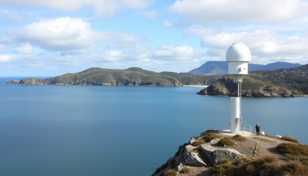
The REG BOM radar refers to the Regatta Point weather radar station operated by Australia’s Bureau of Meteorology. Located in western Tasmania, this radar station monitors precipitation patterns across the island’s western coastline and adjacent inland areas. The station contributes its data to the national radar mosaic, a seamless composite combining readings from approximately 50 radars across all Australian states and territories.
Quick Reference Overview
Key Operational Insights
- Location: Regatta Point radar is positioned in western Tasmania to capture weather systems approaching from the Southern Ocean
- Network integration: Data feeds into the national mosaic viewer launched through BoM updates around July 2025
- Coverage strength: Particularly effective for detecting rainfall associated with cold fronts and low-pressure systems common to Tasmania’s west coast
- Complementary coverage: Works alongside other Tasmanian and mainland radars to provide comprehensive national weather monitoring
- Resolution improvements: The updated system now provides data on a 1km grid, improved from the previous 2km resolution
- Optimal range: Selectable 128km or 256km range loops available for different monitoring needs
- Doppler capability: Supports wind velocity measurements alongside precipitation detection
Radar Station Facts
| Attribute | Details |
|---|---|
| Station Identifier | REG (Regatta Point) |
| Location | Western Tasmania, Australia |
| Operated By | Bureau of Meteorology |
| Maximum Range | 256 km (selectable) |
| Update Frequency | Every 5 minutes (multi-scan cycles) |
| Data Resolution | 1km grid |
| Display Modes | Rain rate (mm/h), Reflectivity (dBZ), Doppler wind |
| Network Coverage | ~50 radars nationwide |
How to View the REG BOM Radar Loop
Accessing the Regatta Point radar imagery is straightforward through the Bureau of Meteorology’s integrated viewing platform. The BoM launched an updated national radar mosaic viewer in July 2025 that consolidates all radar stations—including REG—into a single interactive interface accessible via desktop browsers and mobile devices.
Desktop Access Methods
Navigate to the Bureau of Meteorology’s rain radar page to access the interactive mosaic viewer. Users can pan, zoom, and customize their view by selecting different radar stations from the map interface. When zoomed into Tasmania’s western region, the optimal coverage area for Regatta Point becomes visible with clear boundaries indicating effective monitoring zones.
The viewer offers customizable background options including road networks, river systems, and terrain features that help users orient themselves geographically. Additional layers can be toggled to display rainfall intensity, wind patterns, or combined weather data depending on the monitoring requirements.
Mobile Access Options
The BOM Weather application, available through the Google Play Store, provides free access to radar imagery without advertisements. The app displays current radar coverage, severe weather warnings, and animated loops showing approximately 90 minutes of past rainfall alongside short-term future estimates.
Mobile users benefit from the same 1km resolution data available on the desktop platform, though screen size naturally limits the detail visible without zooming. The app supports offline access to previously viewed radar imagery, useful when monitoring conditions in areas with limited connectivity.
Understanding Radar Loops
Animated radar loops available for Regatta Point display precipitation movement over time, typically covering the most recent 90-minute observation period. These loops help users track storm direction and speed, valuable information for anyone planning outdoor activities or monitoring developing weather situations in western Tasmania.
Standard radar loops for Regatta Point display approximately 90 minutes of past precipitation data, with the animation cycling continuously. Users can pause, step through individual frames, or adjust playback speed depending on their analysis needs.
REG BOM Radar Status: Is It Operational?
The Bureau of Meteorology maintains continuous monitoring of all radar stations including Regatta Point. Status information is available through the official BoM radar page and the BOM Weather application, where users can verify current operational status before relying on the data for decision-making purposes.
Update Frequency and Data Refresh
The Regatta Point radar performs multiple 360-degree scans over approximately five-minute cycles, rotating at varying elevation angles to build comprehensive three-dimensional precipitation observations. This multi-scan approach captures data at different atmospheric heights, enabling more accurate rainfall estimates and improved detection of storm structure.
Processed imagery updates in real-time through BoM’s mosaic system, with the national viewer combining data from all stations into a seamless composite. The improved 1km grid resolution—upgraded from the previous 2km system—provides sharper definition of small-scale, intense rainfall events that might otherwise be averaged into surrounding pixels.
Monitoring Availability
No specific outages affecting Regatta Point were noted in available operational records. However, like all electronic monitoring systems, the radar may experience temporary service interruptions during severe weather events, scheduled maintenance periods, or due to technical issues.
Users requiring backup information during periods of suspected outage can consult the national mosaic viewer, which automatically adjusts coverage display based on real-time station availability. Neighboring Tasmanian radar stations provide overlapping coverage that may partially compensate for brief regional outages.
The BoM radar page displays individual station status indicators. If the Regatta Point station appears unavailable, consult the national mosaic for combined coverage or use the BOM Weather app to verify accessibility through alternative interfaces.
How to Interpret REG BOM Radar Images
Understanding the data displays available through the Regatta Point radar helps users extract meaningful information about current and developing weather conditions. The BoM viewer offers multiple display modes, each presenting different aspects of atmospheric conditions detected by the radar system.
Understanding Display Modes
Rain Rate (mm/h): This display mode estimates rainfall intensity in millimetres per hour. Warmer colours indicate heavier precipitation, with the scale typically ranging from light showers through to extreme rainfall events. Users monitoring for potential flooding or significant precipitation can focus on areas showing sustained high rain rates.
Reflectivity (dBZ): The default display mode measures the strength of radar signal returned from precipitation particles. Higher dBZ values indicate stronger echoes from larger water droplets or ice crystals. This measurement helps identify thunderstorm potential, with values above certain thresholds suggesting hail or intense convective activity. Users can switch between dBZ and rain rate views through the “More weather” settings menu.
Doppler Wind: This mode displays wind velocity data derived from the radar’s Doppler capability, showing the speed and direction of precipitation particles in motion. Useful for identifying wind shear, storm rotation potential, and the approach of cold fronts or wind shifts.
Reading Colour Intensity
Radar imagery uses a standardised colour palette where progression from greens through yellows, oranges, and reds indicates increasing precipitation intensity. Darker reds typically represent very heavy rainfall or large hail, while blues and light greens indicate lighter showers or drizzle.
It is important to note that radar signals can be affected by factors other than precipitation. The BoM’s updated processing engine removes clutter artifacts caused by mountain ranges, buildings, and other static objects that previously created false echo displays. The system now prioritises lowest available elevation observations for ground-level accuracy.
Radar imagery shows precipitation in the atmosphere, not necessarily surface rainfall. Some rainfall evaporates before reaching the ground (virga), and the radar beam may overshoot shallow precipitation at greater distances. Ground-based observations remain essential for confirming actual rainfall amounts.
How REG Compares to Other BOM Radars
Australia’s radar network encompasses stations across all states and territories, with each location optimised for specific regional monitoring needs. Comparing the Regatta Point radar to other stations highlights both common features and unique capabilities suited to Tasmania’s weather patterns.
Coverage and Range Comparison
| Feature | Regatta Point (REG) | Capital City Radars | National Mosaic |
|---|---|---|---|
| Primary Coverage | Western Tasmania coast | Urban and regional centres | All Australia combined |
| Available Ranges | 128km / 256km selectable | 128km / 256km / HD | Dynamic based on zoom |
| Update Cycle | 5-minute multi-scan | 5-minute multi-scan | Real-time composite |
| Display Modes | Rain rate, dBZ, Doppler | Rain rate, dBZ, Doppler, HD | Switchable modes |
| Grid Resolution | 1km improved | 1km improved | 1km consistent |
Regional Strengths and Limitations
Regatta Point excels at detecting weather systems approaching Tasmania from the Southern Ocean, including cold fronts, cutoff lows, and west-coast rain events that are characteristic of the region’s climate. The radar’s placement captures orographic rainfall induced by the island’s mountainous terrain, providing valuable data for hydrographers and water resource managers.
Compared to capital city radars such as Sydney or Melbourne, the REG station serves a smaller population base but remains critical for maritime interests, fisheries, and western Tasmania communities. The absence of large urban interference means less ground clutter, though the rugged terrain can create some viewing shadows behind mountain ranges.
All radars in the BoM network—including Regatta Point—feed into the unified mosaic viewer, eliminating the need to navigate between individual station pages. This integration means users monitoring large-scale weather events can seamlessly pan from Tasmania to mainland Australia without changing interfaces or losing contextual awareness.
Timeline of REG Radar Operations
Weather radar technology in Australia has evolved significantly since initial deployment, with the Bureau of Meteorology continuously upgrading capabilities across the national network.
- Network establishment: The Bureau of Meteorology established regional radar stations including Regatta Point during the early 2000s as part of a national network expansion to improve weather monitoring coverage across Australia.
- Digital processing upgrades: Subsequent upgrades introduced digital signal processing, improving data quality and enabling more sophisticated precipitation classification algorithms.
- Resolution improvement initiative: The 2024-2025 enhancement programme increased grid resolution from 2km to 1km, providing finer detail for small-scale weather features and improving accuracy of rainfall estimates.
- National mosaic launch: July 2025 saw the introduction of an integrated national mosaic viewer, consolidating all radar stations into a single interactive platform with improved navigation and display options.
- Ongoing maintenance: Regular calibration, equipment updates, and software improvements continue to maintain operational reliability and data quality standards.
What We Know and What Remains Uncertain
Clear communication about the extent of available information helps readers understand the reliability of data presented and identify areas where additional verification may be required.
| Established Information | Information Requiring Further Confirmation |
|---|---|
| Regatta Point radar is located in western Tasmania | Specific scheduled maintenance windows (not publicly announced in advance) |
| Station contributes to national mosaic viewer | Details of planned future hardware upgrades beyond general 2025 improvements |
| 5-minute update cycle with multi-scan elevation | Historical outage records and causes (not comprehensively documented online) |
| 1km resolution following 2024-2025 upgrade | Precise technical specifications for Doppler wind measurement accuracy |
| Available display modes include rain rate, dBZ, and Doppler | Specific data retention periods for archived loop access |
| Access via bom.gov.au and BOM Weather application | Detailed coverage gap maps showing terrain shadowing effects |
The REG Radar in Tasmania’s Weather Context
Tasmania’s climate is heavily influenced by its position in the Southern Ocean, with western regions experiencing some of the highest annual rainfall totals in Australia. Weather systems affecting this area typically approach from the west and southwest, bringing moisture-laden air masses that interact with the island’s mountainous terrain to produce significant orographic precipitation.
The Regatta Point radar provides essential monitoring capability for these moisture-laden systems. During active storm periods, the radar helps forecasters track the movement and intensity of cold fronts, cutoff lows, and atmospheric river events that can deliver substantial rainfall within short timeframes. Emergency management agencies rely on this data when assessing flash flood potential in western Tasmania’s river catchments.
Marine and coastal interests also benefit from the radar’s coverage. Commercial fishing vessels, aquaculture operations, and recreational boaters operating in the waters west of Tasmania use radar imagery to anticipate deteriorating conditions before venturing offshore. The combination of precipitation detection and Doppler wind capability provides a comprehensive picture of developing weather hazards.
Seasonal patterns in Tasmania include increased storm activity during the cooler months when frontal systems are most frequent. During these periods, the Regatta Point radar typically operates at heightened monitoring levels, with data refresh rates and alert thresholds adjusted to match the elevated risk environment. Understanding these seasonal patterns helps users anticipate periods when radar data may be particularly valuable for planning purposes.
Sources and Additional Information
All information regarding the Regatta Point radar (REG) presented in this guide derives from official Bureau of Meteorology sources, including the BoM radar mosaic viewer documentation, published updates about the national network, and the BOM Weather application specifications. Users seeking the most current operational status should consult these primary sources directly.
“Radar imagery provides essential real-time data for weather forecasting, severe weather warnings, and hydrological monitoring across Australia.” — Bureau of Meteorology official guidance
Summary
The REG BOM radar—Regatta Point station in western Tasmania—serves as a critical component of Australia’s national weather monitoring network. Operated by the Bureau of Meteorology, this radar station tracks precipitation and wind patterns across Tasmania’s western regions, contributing data to the integrated national mosaic viewer launched in July 2025.
Users can access live radar imagery through the Bureau of Meteorology website or the free BOM Weather application. The station operates on a five-minute update cycle, providing 128km and 256km range options with rain rate, reflectivity (dBZ), and Doppler wind display modes. Recent upgrades improved resolution to a 1km grid, enhancing detection of small-scale weather features.
For those monitoring weather conditions in Tasmania, the Regatta Point radar offers valuable real-time data. Checking operational status before relying on the information, understanding the various display modes, and interpreting colour intensity appropriately will help users extract maximum benefit from this monitoring resource.
Frequently Asked Questions
What does the REG BOM radar abbreviation mean?
REG refers to the Regatta Point radar station operated by the Bureau of Meteorology in western Tasmania. The three-letter code identifies this specific station within BoM’s national radar network.
Why might the REG BOM radar show reduced coverage?
Radar coverage can be limited by the terrain around the station. Mountains and elevated features can create shadow zones where the radar beam cannot detect precipitation. Additionally, the radar may be temporarily unavailable during maintenance or technical issues.
How often does the REG BOM radar update its imagery?
The radar performs multiple 360-degree scans over approximately five-minute cycles, with processed imagery updating in real-time through BoM systems. This means users typically see new data every five minutes.
Can I access the REG radar on my mobile phone?
Yes, the BOM Weather application available through the Google Play Store provides mobile access to radar imagery, including animated loops showing 90 minutes of past rainfall. The app is free and contains no advertisements.
What is the difference between rain rate and reflectivity (dBZ) display modes?
Rain rate estimates actual precipitation intensity in millimetres per hour, while reflectivity measures the strength of radar signal returned from precipitation particles. Both help identify heavy rainfall, but rain rate provides a more intuitive measurement for most users.
How far does the REG radar’s coverage extend?
Regatta Point offers selectable 128km and 256km range options. Coverage quality varies with distance and terrain, with optimal detection closest to the station and reduced accuracy at the outer edges of the range.
Is the REG radar available during severe weather events?
The radar is designed to operate during severe weather, though electrical storms and extreme conditions can occasionally affect equipment. The national mosaic system automatically compensates for individual station outages by relying on nearby radars.
What do the colours on radar imagery represent?
Colours indicate precipitation intensity, with greens representing light rainfall, yellows and oranges indicating moderate to heavy precipitation, and reds signifying very heavy rain or hail. The specific colour scale is displayed alongside the radar image.
Related stories


Liam O'Brien covers Australian politics and public affairs for Coast Current.